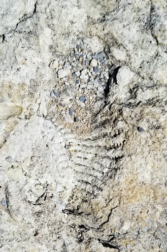
And here are more:
Does this give you a clue?
The size looks right
Sometimes they are enhanced by the river water
And they usually form a linear pattern
By now you have guessed. Sauropod (Greek = "lizard foot") tracks. These are in the Glen Rose formation of the Lower Cretaceous.
The Glen Rose is a widely distributed shallow-marine formation as indicated both by ripple marks and abundant marine invertebrate fossils.
These types of tracks are not that uncommon in Texas but these are conveniently close to Austin and San Antonio. How do you get there:
Take FM 1623 west of Blanco. In just over three miles you pass the intersection to CR 103 (Trainer Wuest Rd.) on the left. Shortly thereafter, there is safe and convenient parking on the side of the road. Walk back to Trainer Wuest Rd. and take it down to the river. If it is safe to do so, you can then hike the river bed east (towards Blanco) for a few hundred yards and should easily see plenty of tracks in the exposed Glen Rose formation. Its then probably worth backtracking to the Trainer Wuest Rd. river crossing and keep on going to the west for half a mile or so. There are more tracks to see on this stretch.
Some other thoughts:
- Never, ever hike the river bed if the water level or flow rate creates an unsafe situation.
- This blog entry does not imply that it is legal to access the river bed in Blanco County. I have no clue about private land/river rights.
- The dirt road (Goldwin Smith Rd.) on the south side of the river is definitely private property.
- See last week's blog entry for info. about the therapod (carnivore) tracks on the San Gabriel River.


Excellent photos.. I am glad you found the tracks and not the beasts that left them!
ReplyDelete